
Cedar Rapids ZIP Coverage
The Iowa DPS city table lists fourteen codes for Cedar Rapids. Four have broad area descriptions in inspected local maps, while others need an exact USPS address check. The type matters as much as the number. Standard codes can describe street delivery areas; PO Box and Unique classifications cannot be drawn as ordinary residential blocks.
| ZIP | Areas Covered | Post Office | Notes |
|---|---|---|---|
| 52401 | Central and downtown context | Main, 615 6th Avenue SE | Standard |
| 52402 | Northeast and east-side context | Northeast, 1380 60th Street NE | Standard |
| 52403 | East and southeast context | Confirm with USPS | Standard |
| 52404 | West and southwest context | West, 1930 Wiley Boulevard SW | Standard |
| 52405 | West-side context | Confirm with USPS | Standard |
| 52406-52410 | Not street-neighborhood areas | Confirm box assignment | PO Box codes |
| 52411 | Exact streets require lookup | Confirm with USPS | Standard |
| 52497-52499 | Special delivery assignments | Confirm current use | Unique codes |
The Linn County ZIP map supplies area context, not a delivery promise. No official split or realignment year was found, and no official per-ZIP population or voter count was located. Those gaps should not be filled with estimates.
Check Cedar Rapids ZIP Assignments
The USPS ZIP Code Lookup supports address, city and state, or cities-by-ZIP modes. For an address, enter the company only when relevant, plus street, city, and state. Add unit detail because two units at one street number may route differently. A ZIP result standardizes delivery information; it does not identify a person.
| Lookup mode | Input | Result |
|---|---|---|
| By address | Company optional, street, city, state | Standardized address and ZIP |
| By city and state | City and selected state | ZIP choices and accepted city names |
| Cities by ZIP | Five-digit ZIP | Associated city names |
| Multiple addresses | Full street and unit detail | Narrower delivery match |
The Main Post Office result lists 319-399-5560 and hours of 8:00 a.m. to 5:00 p.m. Monday through Friday, with Saturday hours of 9:00 a.m. to noon. Use the USPS locator or postmaster for current box and unique-code assignments.
Cedar Rapids Parcel ZIP Fields
Property systems preserve a second view of ZIP geography. The county parcel layer holds situs city and ZIP, parcel number, legal description, owner deed or contract fields, geometry, and a recorder link. Situs means the physical parcel address. Cedar Rapids parcel data also exposes five-digit and four-digit postal fields, city, site address, and parcel geometry.
The official Linn County parcel ZIP layer shows the field structure behind a ZIP query.
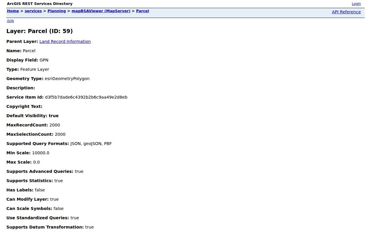
The captured layer can return parcels matching a ZIP or map choice. It is a technical record source, not a ready-made household list. Query rules and page limits belong to the service, and an owner field does not prove occupancy.
| System | ZIP field or control | What it returns |
|---|---|---|
| Linn County GIS REST | Situs City, Situs Zip, query options | Matching parcel records and geometry |
| Cedar Rapids parcel REST | PSTLZIP5, PSTLZIP4, PSTLCITY | City parcel features |
| Cedar Rapids geocoder | Street required; city and ZIP optional | Candidate standardized addresses |
| City assessor form | No ZIP field exposed | Street and parcel results, not a whole ZIP |
Find Cedar Rapids Residents by ZIP
A ZIP code directory can narrow a large search, but official tools require more context. Begin with the postal address, compare it to parcel geography, and only then use a record system that accepts ZIP. Iowa's voter form uses a name, ZIP, house number, and birth date to verify registration and polling details. It does not publish a ZIP-wide resident roster.
- Confirm the complete street, unit, quadrant, and current postal code through USPS.
- Compare the address with the city or county parcel layer, based on which assessment system covers it.
- Use a ZIP-capable official index, such as the professional license search, only for its stated record purpose.
- When checking voter status, supply the required personal fields to the state verification form.
- Once the result narrows to a named road, continue with the Cedar Rapids street directory for address-level records.
A professional license result can show name, board, status, city, ZIP, and license number. It confirms a license record, not a home. Keep each result tied to its source date and purpose.
Cedar Rapids ZIPs and City Limits
ZIP boundaries serve mail delivery, while Cedar Rapids limits govern municipal jurisdiction. Linn County parcel polygons, neighborhood association areas, voting districts, and old Sanborn blocks create still more boundaries. They may overlap, but they should never be treated as one layer. A Cedar Rapids mailing label does not by itself show that a parcel falls inside the city assessment system.
This distinction affects where to search. A city parcel begins with Cedar Rapids assessor or parcel services. Surrounding property may belong in Linn County GIS. For delivery, USPS controls the current assignment. For city status, use official municipal and transportation maps. Compare the fields rather than overwriting one with another.
ZIP geography narrows a lawful personal search, but it never proves identity, occupancy, or permission to contact or harass a person.
- ZIP code
- A five-digit postal routing area that is not a city boundary.
- ZIP+4
- The added four digits that refine delivery within a five-digit area.
- PO Box ZIP
- A code used for post-office boxes, not a residential street zone.
- Unique ZIP
- A special assignment that may serve one organization or delivery setup.
- Carrier route
- A postal delivery path inside a ZIP, not a parcel or neighborhood line.
Cedar Rapids Quadrants Change Addresses
Cedar Rapids uses 1st Avenue and the Cedar River as address baselines. NE, NW, SE, and SW are not decorative suffixes. They change an address's geographic meaning. Dropping the quadrant can send a parcel, directory, or postal search to the wrong side of the grid.
Preserve an old address exactly when working from a city directory. Then test a separate normalized version in USPS and the city geocoder. A current ZIP map, a legal parcel map, and a historic Sanborn sheet may tell compatible but distinct stories about the same place.
Note: Record both the printed historical form and the standardized modern form, then state which source supplied each version.
Cedar Rapids Box and Unique ZIPs
Codes 52406 through 52410 are classified as PO Box codes in the inspected DPS table. They cannot define a residential block. Codes 52497 through 52499 are Unique classifications, and the exact current institution or assignment was not found in official inspected sources. Do not guess from an organization name or old mailing label.
A box may help confirm that a person or group received mail through Cedar Rapids at a certain date. It does not locate a dwelling. Check USPS for the current assignment, and use dated city directories or newspapers when the goal is historical postal routing.
Historical Cedar Rapids ZIP Research
Older directory volumes may omit ZIP codes because the modern system did not yet apply to that entry. Search the street and quadrant first. The Community History Archive's telephone books and directories span 1876 through 2017, Sanborn maps span 1884 through 1936, and Linn County census pages span 1840 through 1930. Newspapers can date when a postal form appeared.
Historic postal routing material is context only unless USPS confirms it remains current. Likewise, an old accepted city name should not silently replace today's standardized city field. Keep the publication date beside each address and ZIP.
Troubleshoot Cedar Rapids ZIP Results
When two official tools disagree, first check whether they describe delivery, situs, mailing, or legal geography. Those fields may differ without either record being wrong. Re-enter the unit, confirm the quadrant, and test the accepted city name returned by USPS.
- Check all digits and keep leading zeros if a form requires them.
- Add apartment, suite, or unit detail before accepting a match.
- Identify whether the result is Standard, PO Box, or Unique.
- Compare parcel situs ZIP with the mailing ZIP as separate fields.
- Save the source date because postal and portal data can change.
No official Cedar Rapids ZIP realignment year was located. Current delivery questions belong with USPS, while parcel and city-limit questions belong with the relevant GIS custodian.